AROUND TASMANIA
TASMANIA
The remote and little-known Australian island of Tasmania was the seventh stop of our OCEANS 8 project. Drawn by its mysterious history and wild and rugged shores, it proved to be perfect coastline for us to explore by kayak, stopping along the 600-mile route to visit with fishermen and historians, sailors and folkloric legends.
AROUND TASMANIA
DISPATCH ONE
O
ur first day in Tasmania dawned serendipitiously.
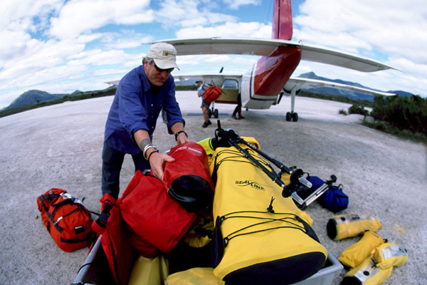
We are readying to fly a twin-engine, 9-passenger Cessna to the remote southwest corner. Our kayaks were delivered there by boat a few weeks ago. But it is a somewhat unusual morning,filled with a very rare commodity here – a blue, blue sky filled with sunshine.
As the five of us – my old pal Alex Nicks, photographer Keith Fialcowitz, Travisi Holmes and Lelia Meffre – load 300 kilos of gear, nearly 650 pounds, into theback of the small plane it actually gets … hot.
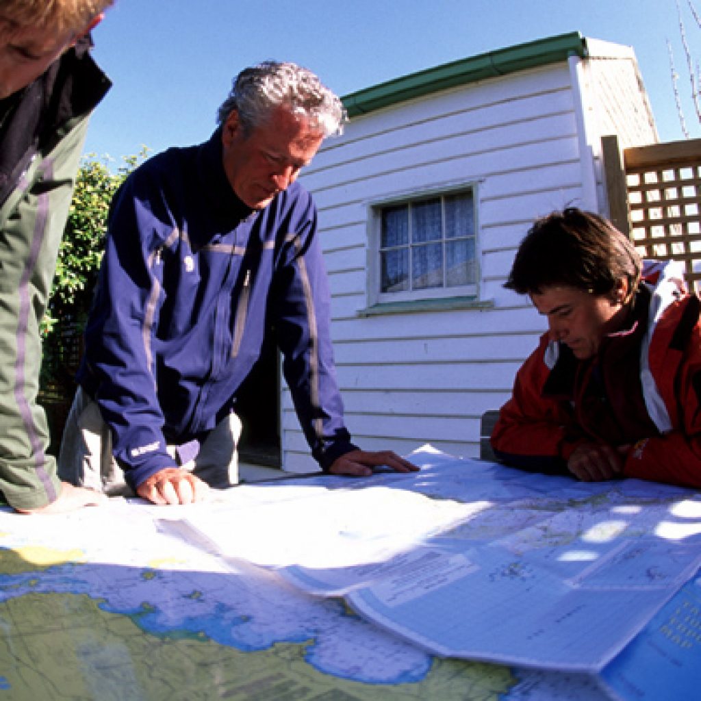
We kneel on the tarmac with our pilot, Stuart, and as I draw my finger along the jagged southern coast, I not so subtly suggest it would be FANTASTIC if we could follow the coastal route rather than the more direct interior line.
It didn’t take much suggesting … pilots are usually happy to go for a fly on a beautiful blue-sky day.
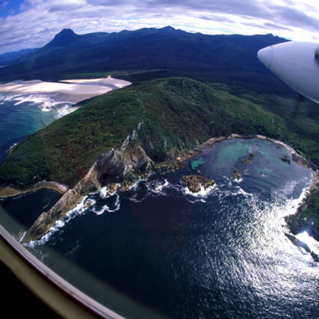
The scenery that unfolds out the right side of the the plane is inspiring, and we have caught it on a rare day. Often, this southern coast is hammered by 20-30 foot seas built up from the nearest body of land – Antarctica.
Fate is with us; I wanted a perspective on this coastline we will be paddling back along in a week’s time … and today is perfect, calm and placid. White surf rolls against the 100-foot tall cliffs at Soldiers Bluff and laps along the sand Isthmus that connects North and South Bruny Islands.
We dip close to have a look at Prion Bay and Cox Bight. Twelve miles off the coast lies Matsuyker Island and a pair of tiny spits of rock called Flat Top Island and Round Top Island.
The entire southwest corner of Tasmania is national park. In 4,000 square miles lives just one couple in their 70s. Pete and Barbara Wilson mine tin there near Melaleuca and maintain the airstrip. They have leased the land here for mining for nearly 40 years. Their nearest neighbor is 150 miles away.
This is as remote a part of the world as you’ll find and where … tomorrow … our adventure begins.
Today, we are thankful for the warmth and sunshine, knowing it will not last ….
DISPATCH TWO
R
remember all that folderol yesterday regarding the abundant sunshine and placid seas?
Well, forget about all that.
Our first full day in the bush and the real Tasmania showed up ….
According to the weather report, we were told a “vigorous front” was moving through the region.
Vigorous? That’s a first.
But the result was not the four-seasons in one day which we fully anticipated. More like four seasons in 15 minutes: Rain, sun, rainbows, 40 mile per hour winds, hail, more rain and wind and on and on and on, all day long. The fastest-changing weatherI’ve ever seen.
One big indicator: We climbed to the top of Charlie’s Hill, just 700 feet above sea level, and 10 miles away we could see waves crashing on the beach at Cox Bight. Meaning seas of 30 to 40 feet …
The weather didn’t stop us from a bit of exploring, and – for us from the northern hemisphere, all kinds of new and fun sightings ….
My teammates Lelia meffre grew up on a sailboat. When she was 12 she remembers they anchored the family boat in Bathhurst Bay, near where we are camped, and spent two months here. Part of her education was tramping around these meadows and hills and harbors.
She points out carnivorous plants, a pepper tree and yabi holes – home to small, land-based cray fish.
The peat bog we walk on is springy, like a big, black sponge, but soft enough to capture the long footprints of a wallaby – relative of the kangaroo – its long tail leaving a distinctive brush mark in the mud.
We spy a 200-year-old eel in a shallow pond. And wander past one of the weirdest critters I’ve seen, an echidna – close relative to the platypus, with porcupine-like quills. Born in an egg, but weaned on mothers milk, when we find it in the middle of the track it immediately attempts to burrow into the sand. Lelia gets her fingers underneath it quickly and picks it up to show off its long snout ….
Darting about we also spy a few of the last orange-bellied parrots on the planet. In fact, the last 200 of the very endangered species spends six months a year right here … in the middle of Southwest National Park.
Suffice to say it was an auspicious day on all fronts. Now if the temperature would just climb back above 40 degrees.
DISPATCH THREE
J
anet King Fenton is a disciplined and extremely well-versed naturalist, with a great laugh. She may know more about southwest Tasmania’s flora and fauna, in part because she spent her childhood here – smack in the middle of what is now a 4,000 square mile national park.
Her father, Denis King, and her grandfather, Charles King, were pioneers here, homesteading and tin-mining going back to the 1930s. It was largely her fathers lobbying – as well as the occasional fire-fighting and construction skills, including building the airstrip – that got this corner ofTasmania designated parkland to begin with. Today, some 5,000 bushwalkers a year pass through – it’s probably a good thing he’s not still around – since he used to bake bread for the rare visitors during the 60s, 70s and 80s … now that would be a full time job.
Yesterday we climbed Charles Hill, named for Janet’s grandfather; today, with Janet, we hike to King’s Knob, named for her family.
Along the way we stop every five minutes and assume the naturalist’s position – on our knees and elbows, examining some tiny, colorful flower or another – the fairy apron, a trigger planet, carnivorous sun dews … and more.
A teacher, author and painter, as well as current president of Tasmania’s Naturalist Club, Janet lives about six months of the year here. Her family holds a lease in the parkland for another 10 years and she hopes her kids, now in their 20s, will be able to stay in this place she calls home … and her grandchildren too.
She remembers her childhood in this remote, often harsh country as idyllic. She never wished to live in town – though finally she was sent away to Hobart to go to school, after year’s of correspondence learning by radio – and didn’t envy other kids who lived ‘in town.’
“Some people call this part ofTasmania the end of the world,” she says, as we walk down off King’s Knob in a light rain.
“But for me, this is the center of the world!!”
DISPATCH FOUR
O
ur good fortune continues; despite a wet night the morning arrives warm and calmand the sky blue again.
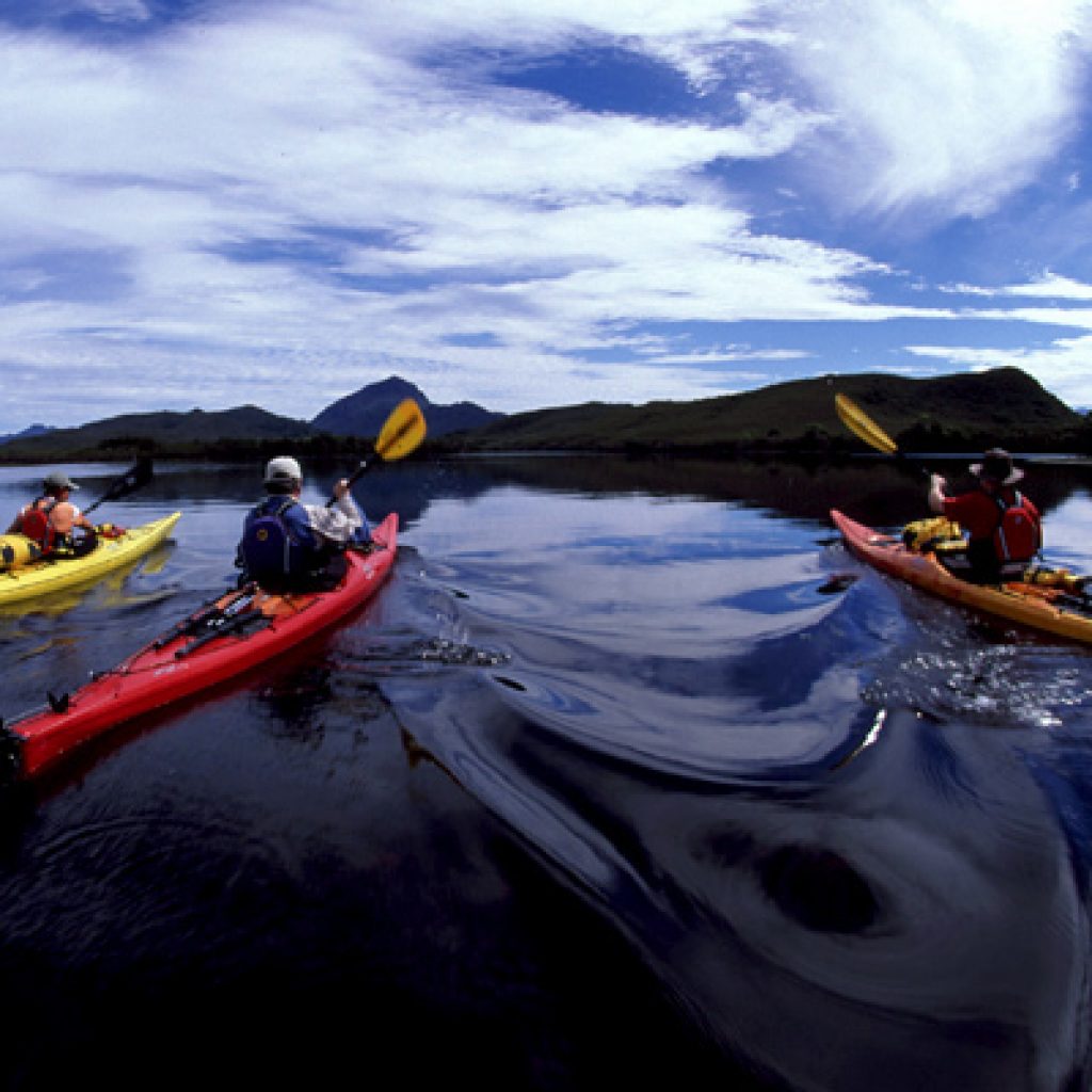
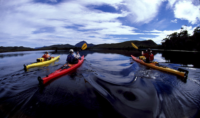
By 10 o’clock when we push our kayaks – into Melaleuca Lagoon for our first paddle – it’s nearly 70 degrees.
Our course is simple today – up Melaleuca Inlet, a long, winding connector, to Bathhurst Harbor. Once there, we head due west, towards the Southern Ocean.
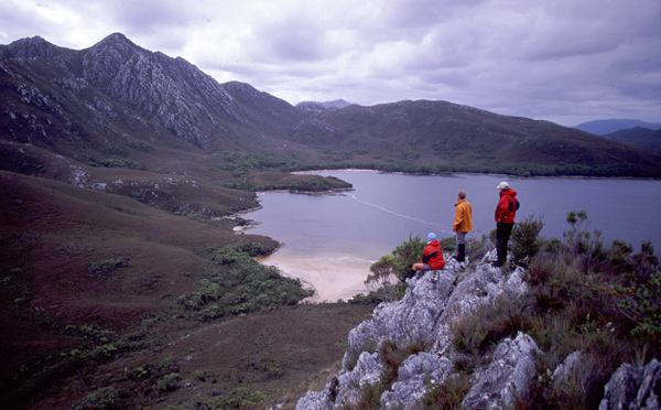
The water is perhaps the most interesting thing of the morning; specifically its color. It is black as night – from the tannens that leach into the sea from land. Near to shore, and on inland creeks, they turn brown … but out here, where there is some depth, the black is impenetrable.
Along the shores are small forests, mostly of eucalyptus. We ask ourselves all day long what this landscape reminds us of, what other parts of the world we’ve seen. Could make sense that it reminds of Patagonia, since Australia broke away from souther Chile/Argentina – Gondwanaland – those millions of years ago. Latitude-wise – at 42 degrees – it’s similar to northern Oregon. But it is more rugged, more dramatic than that. The mist in the green hills feels Scottish … but that it is all surrounded by this deep, black water gives it a one-of-a-kind, only-in-Tasmania feel.
The winds and currents and tides pick up as we paddle through Bathhurst Narrows. And the spray begins to taste … salty …another first.
Since we are off now, a bit about my traveling partners:
Alex Nicks has accompanied me on four recent trips, shooting video. A wry Brit, and former white water kayaking champ, it is often hard for him to fathom himself in these big sea kayaks. “The only problem with sea kayaking,” he said to me today, mid-narrows, “is all the bloody sea kayaking. I mean, where’s the gradient!!”
This is the first time I’ve traveled with LA-based photographer Keith Fialcowitz, and his rigging system for taking pictures on the water from a kayak is impressive. All the contraptions mounted on his bow (or stern) make his boat look vaguely and simultaneously prehistoric and futuristic.
Lelia Meffre was our main logistical contact in Tasmania; born in France she grew up on a sailboat, all around the world, which her parents documented in books and videos, big sellers in France. They stopped for long periods in Tasmania and she has now built a home here.
She and her partner, Travis Holmes, are both instructors for the National Outdoor Leadership Schools, or NOLS. Travis was born in Edmonton where he soloed his first canoe at age six. Having wilderness skills teachers along is an incredible luxury!
Our first camp is at Balmoral Beach, wide and sandy, though we tuck our tents into the forest, to hide a bit from the coming … rain. You didn’t think it was going to stay balmy all day long … did you??
DISPATCH FIVE
I
n 1999, I did a big trip with sea kayaks through the heart of the Aleutian Islands. Specifically, we spent five weeks exploring a small chain of volcanic islands called The Islands of Four Mountains. That was our first OCEANS 8 expedition.
Before going out to the Aleutians I read a book about that region, written in the 1930s, called, “Where the Sea Breaks Its Back.” The title came from an Aleut phrase, describing that place where the northern Pacific Ocean crashed into the cold Bering Sea.
Today, nearly 7 years later and on the far side of the globe – many thousands of miles from the Bering Sea – and we are readying, on a cool, grey day, to paddle out to a small group of rocky spits rising out of the sea known as “The Breaksee Islands.”
At the very southwest corner of Tasmania, this is where the Southern Ocean first hits, land … on the … Breakseas.
Obviously, thereis a trend here, involving big seas crashing onto hard, remote rocks.
Early this morning we climbed Mt.Milner to scout our paddle to the edge of the Southern Ocean. The black sea was windswept, with rolling four and five meter swells and wind-created whitecaps. All we knew about the day’s weather was that it was supposed to calmer … tomorrow …
When we finally got out onto the water – after pushing loaded kayaks over 50 feet of tide-drained beach – it was still grey, but as we paralleled the Breakseas – beautiful green, with big white and blue waves crashing off their southernmost point – the winds diminished.
We spent a couple hours paddling on the edge of the sea, in big but manageable swells of four and five meters – 12 to 15 feet. For a few minutes, right at the edge, with all land at my back, I pointed the tip of my kayak straight ahead, paddling due south. If I continued? Next stop … Antarctica.
(A very long trip by kayak; big boats carrying supples for Antarctic research bases leave from Hobart and arrive in Antarctica two weeks later ….)
After navigating various criss-crossing swells and big waves rebounding off the islands, we make our way to Spain’s Bay, a four-kilometer long sand beach.
Our camp is tucked on a point – a triangle and all night long we could hear the sea breaking on two sides – softly onto the beach and – two kilometers away – big, ocean swells crashing onto nearby southern cliffs.
DISPATCH SIX
W
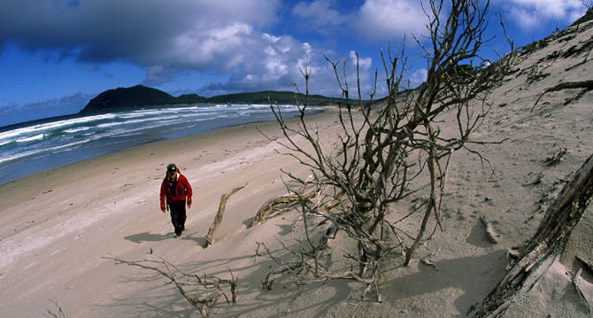
e walked through thick scrub and open fields of button grass this morning to reach a mile long, crescent sand beach behind our camp at SpainBay. White breakers crashed onto the wide sand beach; in front was nothing but open ocean and offshore rain squalls, alternating with bright blue skies.
As we walk on the hard sand of the tide line we observe a wide spectrum of the natural order – a dead sea lion, an injured yet still very dangerous tiger snake, a dead penguin and a blue-footed booby… along with a trio of speckled ____ eggs in the sand, on the verge of hatching.
Our goal were aboriginal middens that we knew lay at the far, eastern end of the beach. Basically, these were giant garbage dumps left behind by the early inhabitants of Tasmania. In their remnants of shells and bones they are the best-preserved record of life here going back thousands of years.
Because these are so remote and subject to the daily crashing waves of the southern Ocean, they are accessible to the few who come this far.
We clamber up what, to the naked eye, appears to be just sand dune. Thirty feet high and spread back over a square quarter of a mile, the obviously man-made mounds continue deep inland. As we kick up the sand, our toes uncovers tens, hundreds, thousands of empty shells, a wide variety of bones, remnants of charcoal fires and rough-hewn cutting tools. This heap goes back probably 1,000 years; others in Tasmania have been traced back 8,000 years.
This place is where nomadic tribes would stop for months at a time. This particular site offered protection from the winds and a nearby stream for fresh water.
Lelia’s sharp eye quickly picks out a black rock, not native to this area. Sharpened into a cutting tool, for preparing fish or skinning a wallaby, it was carried here, or traded for. Other rocks have been chipped away too, to make cutting and scraping tools. Though archeologists have previously visited this site, to us it seems like a real discovery … atop the heap are abalone shells, bird leg bones, fish vertebrae, kangaroo legs, whale bones and more.
It is difficult to picture aboriginal life out here, in part because there is so little record. Like so many parts of the planet, once the Europeans arrived here, the local inhabitants suffered; here they were quickly and efficiently gotten rid of.
In Tasmania it was no different; a race of native peoples that had existed for 10s of thousands of years was killed off in less than 100. The last full-blooded aboriginal died in 1867. Today, the closest relative is just 1/64th aboriginal.
As a result, these middens we are examining under a blue sky remain one of the best records of what existence, that history. Though it was a garbage heap to them, it’s ironically taken on vast and new significance, and a slightly more reverent one, on this sunshine filled day.
DISPATCH SEVEN
W
e awake this morning in our camp at Spain Bay to an unusual sound: An engine. We’d grown quite accustomed already to hearing only pounding surf and wind. This man-made intrusion was a surprise, but a good one!
Inquiring by VHF radio, we discover it is “The Velocity,” and its two-man cray-fishing crew; and that they are headed back towards the southeast corner, along the southern coast, in just af ew hours. Politely, we ask if we can hitch a ride. Both to get past some of the most exposed and least landable coastline and to watch a working cray – or lobster – boat at work.
The Velocity’s captain, David Wyatt, is the son of a builder who took to the sea rather than follow in his father’s footsteps. But while lobstering was his business, and a t $35 a kilo not a bad business, we were quickly onto his real passion: As we load our kayaks onto his back deck we spy several surfboards hanging in the rigging. For Wyatt and his 22-year-old deckie, Nick Harris, the daily routine while at sea is simple: fish, surf, fish, surf, sleep, fish, surf, surf, fish, etc.
The pair had been up for about 24 hours and after grabbing just an hour of sleep are ready for the return. They had ‘shot” (or placed) lobster pots during the night and would retrieve them on the way back home. The weather had been, in David’s words, “niggly,” just before they found safe harbor here, which translates as … bad. Thirty-five foot seas, with lots of wind, making for rough, rough sailing. “My back can’t take it anymore,” says Wyatt, from his full-on-suspension-rigged captain’s chair. “All that jarring and crashing about.”
He has 50 pots; a license today for just a single pot trades for almost $35,000. Via attrition, the Tasmanian cray fleet has declined from 350 boats ten years ago to 280 today. It is long, hard work, but can certainly be profitable. The biggest market? China.
And Wyatt says one reason is a well-managed fishery. “Ten years ago, there were fewer cray and more fishermen. Now the balance seems to be good.”
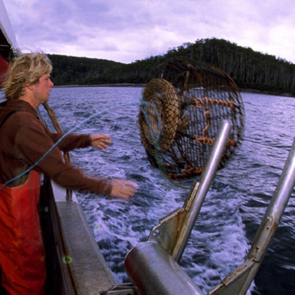
We stop at Dewitt Island, 10 kilometers off the coast, to pick up 10pots. The process is simple. As David steers the boat from bouy to buoy, indicating where the pots were dropped, Nick throws out a metal grapple on a line, snagging the bouy’s lines. Hooking the line around a turnstyle, the pots – made of bent metal rods and bent cane, baited with ‘cuda’ heads – are pulled in over a mechanical roller.
Inside each are between 5 and 20 bright red crayfish. Taking them out by rubber-gloved hand, Nick lays a measure against their tail to see if they are mature enough. He tosses back more than he keeps, allowing them to keep growing, keep procreating. The rest are slid down a short PVC-pipe into a saltwater tank.
The season is 10 months long. Shorter for the egg-laying females. When he has time off, says Wyatt, it’s surfing, surfing, surfing. His holidays are spent far from these cold waters though, on the big point breaks off … Bali.
DISPATCH EIGHT
W
hen we paddle away from Recherche Bay, we all comment on how different the waters look now that we’ve turned the southeast corner and are on the eastern coast. As compared to the southwest corner where they had been ultra-black. With a sandy bottom these are blue-green, looking downright Caribbean.
Our goal today is to paddle to Cloudy Bay, near the southern tip of Bruny island. It would be our most exposed paddle yet, fully open to the winds and swells of the Southern Ocean. We have been checking the weather forecasts daily by VHF and they’ve been pretty accurate. But this morning as we push of the beach it is a good old boy with a chainsaw in his hand who offers the best prediction: “It’s not gonna rain until Friday,” he says. And it was only Monday. He failed to predict the winds, though!
Our options were to paddle up the coast 10 kilometers and then make the crossing, or head straight across. Neither offered any better protection, so … with seas seemingly calm and the wind at our back, we decide to aim straight across. Glancing off the tip of tiny Devil’s Rock Island and heading straight for the lighthouse near the southern tip of South Bruny Island.
We leave the beach at 10:30; by noon we are at Devil’s Rock, greeted on its far side by a big wave breaking towards us. Past that, and we are headed eastward, with swells and waves growing with every paddle stroke, pushing us towards Bruny, only slightly in control.
I managed to peel back the Velcro of my Skanorak to check the time: It is 2:30; we’ve been in the boats, paddling non-stop for 4 hours and we’re not yet to the tip of the island. And by now the sea has turned into something of a maelstrom, a churning mish-mash of waves, 15 to 18 feet tall, pushing from all directions. Riding down one, two others come from opposite sides, squeezing the boats. As I tower on the crest of a 20 foot tall wave, almost two stories above Alex who is ahead of me, in the trough. I think to myself the only good news is that the wind is at our backs and… so far … we’re not being pushed out to sea.
Yet.

Our five yellow and red kayaks plunge up and down in wild seas, a good mile offshore and at least two more hours from a possible landing. The only casualty though, so far, is Lelia’s stomach. Though she grew up on a sailboat she still suffers from seasickness. As delicately as she can, given the conditions, she throws up three times ….
When we finally turn the corner into Cloudy Bay, the big, rolling swells are now completely at our back and at their biggest. Surfing our 17-foot long kayaks down the backsides, we paddle first into a small windy bay, hoping to find a place to land. But the surf is too big, the beaches too rocky.
Which means another 5 kilometers across Cloudy Bay and we’re finally greeted by a welcoming crescent of sand, protected only by a small reef, which we navigate without problem. (Minus Keith, who dumps and soaks a camera!)
Six and a half hours, 30 kilometers after leaving Recherche Bay, we stood creakily out of our boats, having just paddled the biggest seas of our lives.
DISPATCH NINE
W
hen I first saw Adventure Bay on the map of Tasmania, my mind instantly took me to some kind of water park or faux extreme sport center (like I have seen in New Zealand, where people pay to roll down hills in big, inflated balls, or get blown into the air by a jet engine.)
But by the time we pull into Adventure Bay I’ve done some reading; the bay – and small town – were actually named after one of Captain James Cooks’ boats, the H.M.S. Adventure, which sailed in here in 1773, captained by Tobias Furneaux. Captain Cook himself, during his exploration of the southern hemisphere, didn’t arrive here until four laters, in 1777, with his ships the Resolution and Discovery.
Furneaux and the Adventure stayed in this bay long enough to meet some local inhabitants, plant some trees, name a few penguin species, cut some trees … and sail on.
The westerner who sought haven here most though, using the big bay for protection from the southern seas, was Captain William Bligh, who stopped her with the Bounty in 1788, before heading for Tahiti and before his famous mutiny.He would return 3 more times. Our departure from Adventure Bay begins across the road from the Bligh Museum of Pacific Exploration … a brick building built by Tassie convicts from the ruins of an old church.
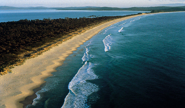
Our day lived up to the so-named bay. We are on the east coast now, a bit protected from the strong southerly or southwesterly winds, and the sun is out full-stop. A sand isthmus, home to nesting penguins, separates South from North Bruny Islands (we paddle past a few penguins today, swimming by … tiny ones …).
Landing the kayaks in the surf always gets the adrenaline pumping and then humping them up and over the dunes and lowering them down a 30-foot cliff on the other side is good for the heart. Only to find the tide WAY out, which means dragging them over wet sand a quarter of a mile.
Just before paddling towards the beach at Great Bay, where we would make camp in a dry, hauntingly beautiful swamp filled with local marsupials, we stop on the rocks to pick dinner. Oysters and mussels, big bags of each. Digging out the spice bag, armed with lemon and Tabasco, we sat on the rocks and ate big, meaty oysters, so many that in a New York restaurant our tab would have easily been a few hundred dollars.
Later, as more oysters grill over the open fire, alongside twin pots of bubbling mussels and the tin-foil wrapped rockfish Lelia caught early in the day, we start our own midden, our own pile of shells.
And we laugh about nomenclature. Our day began at Adventure Bay. The point where we picked up the shellfish is called Chucklehead.
And now that I know the origin of Adventure Bay’s name … guess I’m committed to learning who exactly was Chuckle!!!
DISPATCH TEN
R
isdon Cove, on the outskirt of the capital city of Hobart, sits just a few kilometers inland from the sea. Today – as it has been for centuries – it is a refuge from the sea, its grassy fields and streams offering a perfect escape from the weather. It deserves to be a peaceful place.
But its history is far from peaceful. And its historical significance is important for both aboriginal who have lived here going back 10s of thousands of years, and the Europeans who began living here just a few hundred years ago. The very first being Dutch explorer Able Janszoon Tasman, who spied the west coast in 1642.
In the early 1800s, Risdon Cove was the winter home to the Mumirimina, who had stopped here after a long journey from the north. It was late autumn and they were happy to arrive at a place with caves offering escape from winter weather, and a nearby stone quarry, where they could make new tools.
But in May 1804, when they arrived at Risdon Cove, they were greeted by a new sight: Foreigners. Strangers, British Soldiers, who’d also chosen the spot as a hideaway from the changing seasons.
It was the first time the two “tribes” had met and the result was horrific. Hundreds of men, women and children were slaughtered by British muskets and cannons.
Today, a sign at Risdon Cove marks the historic date with these words: “The first land farmed … the first people massacred.”
Rocky Sainty was born on the northern island of Cape Barren and now lives in Hobart. He is an aboriginal community leader and wears a black t-shirt with the red and yellow aboriginal flag on it; beneath are the words “200 years of suffering.”
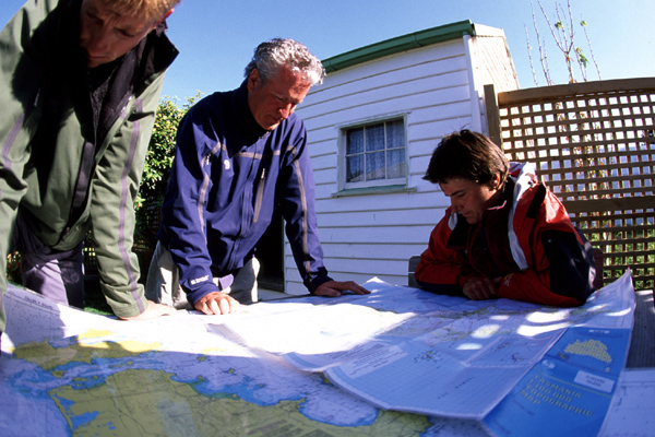
Still, 202 years after the slaughter here, there is anger among the remnants of aboriginal peoples in Tasmania; Rocky’s is quite near the surface as we walk through the park. Bloodlines may have been thinned, having been mixed/diluted by European matings, but whose cultural significance remains strong.
“We are still paying for that day in 1804,” says Rocky, as we walk along a clear creek in the middle of what is now a park. But he was happy at a ceremony near where we stand, in 1995, marking the transfer of this site – and 11 others – back into aboriginal hands. Nearly 3,800 hectares in total. It was the first time since the Europeans arrived and claimed Tasmania as a distant monarchy that any land had been given back to its original inhabitants.
Rocky is a handsome, dark-skinned man with a salt-and-pepper beard. His manner is calm and attitude mostly optimistic. Marine rights—fishing rights – are now on the negotiating table. They want very valuable fishing licenses to be granted to aboriginals, who have been shut out of the business for lack of $$, near his birthplace on Cape Barren might be handed over next.
“Wrongs will never be made right,” he says, looking around at the small park that has been replanted and restored by young aboriginals, “ but we are happy to have this place back.”
DISPATCH ELEVEN
W
e are working our way up the east coast now, and the weather has definitely changed in our favor.days full of sunshine – yet often still windy – but mostly protectedf rom the bigger, more varying seas and swells, fronts and winds from the south/southwest.
And it’s a good thing, too. My friends back home in New York chided me for chasing the sun, running away from winter in the northern hemisphere. To-date it hasn’t felt much like summer here … until now.
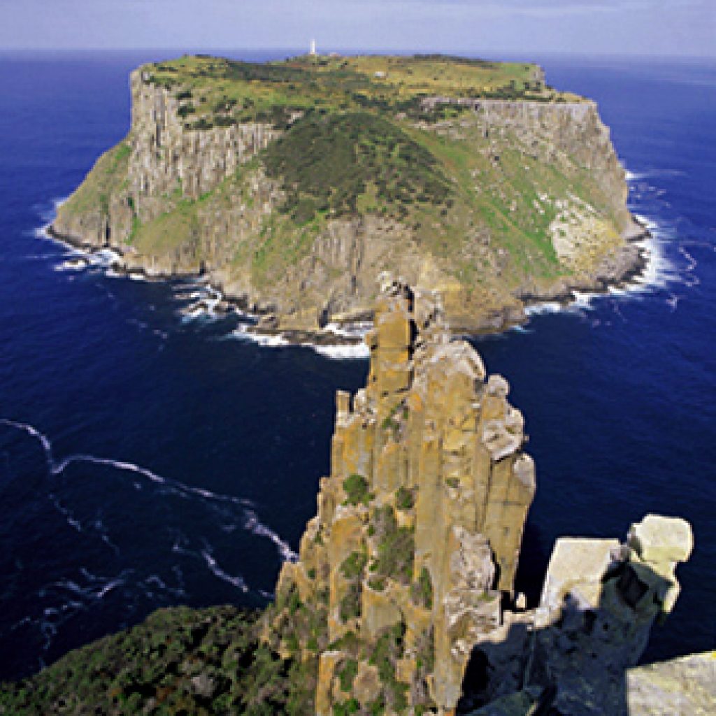
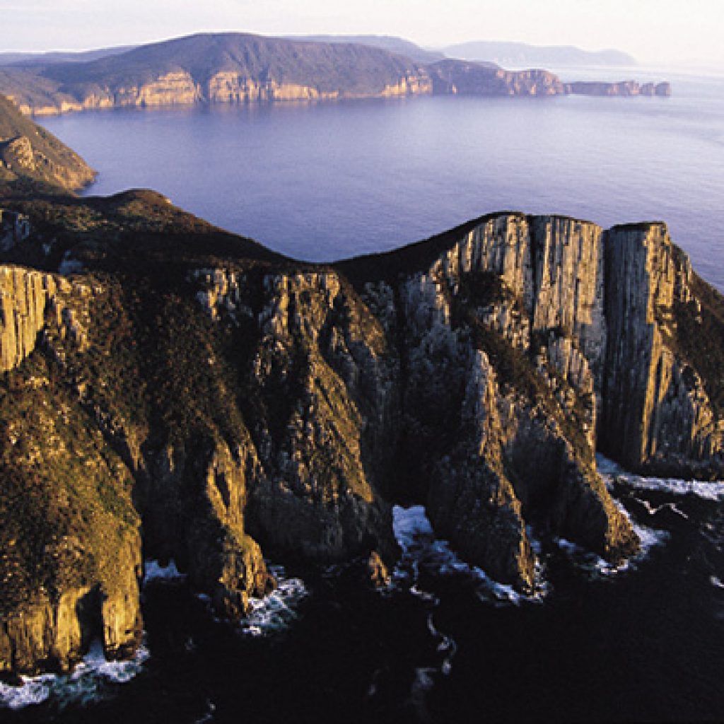
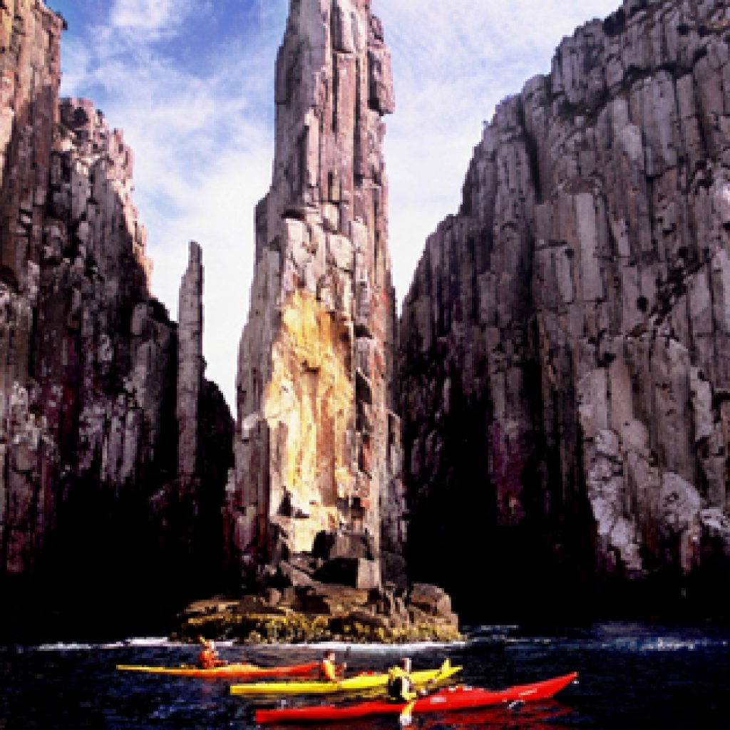
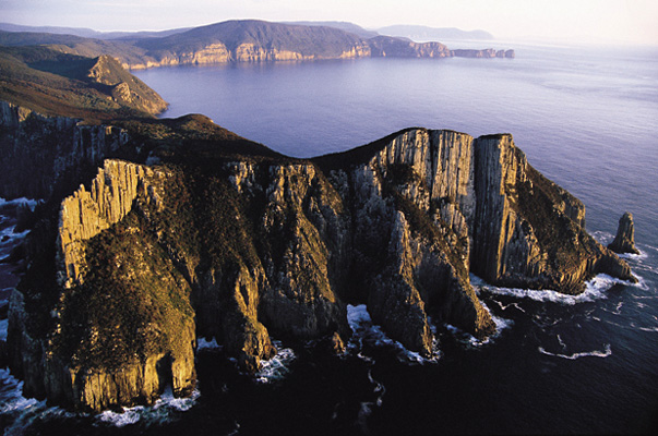
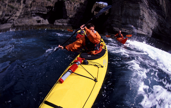
Rounding the corner of the Tasman Peninsula, in the far south and east, far off the mainland, offers one of the most stunning views I’ve ever had from the seat of a kayak. Sitting at sea level at the base of Cape Pillar – a tall, cylindrical rock stack rising nearly 1,000 feet above – make a very big impression. While the swell is big, just next to the wall we are protected from the rolling seas and can sit and gape … up …
Across the channel is an all-male seal colony drying out under organ pipe rocks, beneath an aged, rickety wooden staircase leading up a steep hill to a 100-year-old lighthouse. Lighthouse supplies were unloaded via bucket and winch. In its early days, the lighthouse required a big staff, since its light was generated by hand crank which required an hourly rotation to keep its light on ….
At the very tip of the Tasman Peninsula rise two more tall rock stacks – the Pinnacle and Candlestick – climbing up several hundred feet. Popular among climbers, they have also witnessed their share of climbing-related falls!
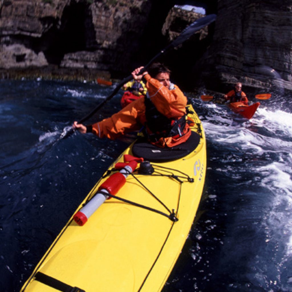
The continuing coastline is filled with geologic as well as wind and weather-created formations. Arches and caves, blowholes and more spires. We poke tips of kayaks into a variety of sea caves and find a couple that make a hard turn and lead back out to the sea.
Further north, across from the town of Swansea, the humps of big Schouten Island and the Freycinet Peninsula are silhouetted in the east. We are finding more and more wide sand beaches. At Bicheno we start to see seaside boulders hosting patches of vibrant orange lichen, beautiful at sunset, against the blue-aqua Tasman Sea.
We pull into St. Helen’s, the biggest seaport on the east coast. There are only four docks, maybe 40 boats. Big in Tasmania is never that big. It is Sunday and the docks are quiet, except for a gaggle gathered around what from a distance appears to be a big rubber shark. Turns out to be the real thing, caught by a tall and gangly 20-something who is somewhat sheepishly showing it off. When he takes it to the public scale for a weighing, a crowd of more than 50 people gathers. The young kids are particularly impressed by the 10-foot long, 245-pound Mako.
One thing we are noticing along this coastline is an increase in clearcut forests, fully loaded logging trucks and pulp mills and wood-chipping plants.
Timber extraction isa hot-button issue all across Tasmania. With 41 percent of the state protected as either national park or World Heritage Site, proponents of logging argue that’s plenty of protection. The anti-logging argument is that most of the protected areas are too wet or windswept for forests … and that some forests should be forever wild too.
As you can imagine, every Tassie has an opinion on this one …..
DISPATCH TWELVE
T
he channel separating Flinders Island from Big Dog Island is bathed in sunshine, but whipped by whitecaps, thanks to a strong wind meeting strong current. Charles Willis’s “tinney” – a 17-foot-long aluminum boat with a deep V hull and 70 horsepower Yamaha bashes through the waves, no problem, with just an occasional spray over its windshield.
We’ve moved offshore to the Furneaux group of islands – there are nearly 70 of them in all, ranging in size from a single hectare to 180 square kilometers. We flew to Flinders Island, the biggest of them all, and have now traveled from the deep southwest of Tasmania to its most northeastern point, across the treacherous waters of the Bass Strait, which separates Tasmania from its big brother, Australia.
The Willis family goes back many generations on these islands; his 85-year-old father Frank was born on nearby Cape Barren island. Charles is taking us out to Big Dog, to his family’s mutton-birding shack, to walk us through the traditional hunting process of the exotic bird. We are a month early to witness the month-long annual mutton bird hunting season, which has cultural and economic significance to both aboriginal and European settlers.
This hunting involves no guns, no weapons of any sort. The only required skill is a willingness to lie face-first in the dirt and plunge your entire ram – sometimes a torso, even your head – down a mutton bird burrow, to grab a two-month old, 4-5 pound chick. Occasionally they bite, sometimes they scratch with their feet, but the biggest worry is that you maybe sticking your arm down a burrow now home not to a bird, but a venomous tiger snake.
The mutton bird is an odd species. Fast fliers, they have a tough time taking off. They migrate 18,000 miles each year, to Canada and Siberia, and return to these remote Tasmanian islands to lay a single egg each year. They spend most of their time in the air, in search of food and are known to fly as far as 600 miles for lunch.
Two million mutton birds – two million! – make their summer home on Big Dog, Little Dog, Cape Barren and a couple other nearby islands.
And the Willis clan, and another dozen families, have birded out here for more than 100 years. Their shack is 50 years old … its corrugated and plank walls covered on the interior with pages torn from movie magazines to help keep the winds out. It is used just once a year, for just one month, so doesn’t require much maintenance. A starling nest as big as a garbage can has been built beneath the stove pipe.
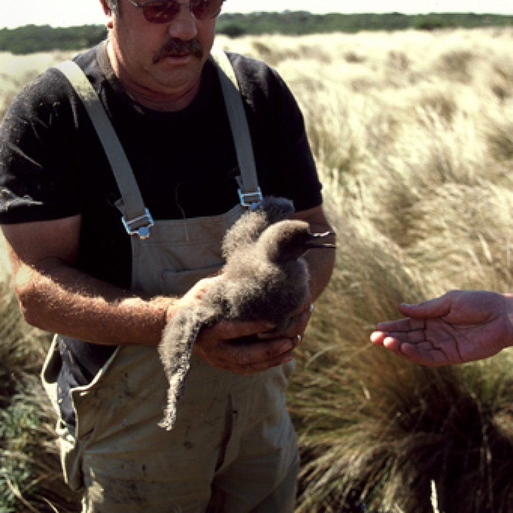
The culture and tradition of mutton birding is shared by both aboriginals and Europeans. It is a fowl business, so to speak, thanks to the birds oily, pungent skin and the fact that in order to “hunt” the birds you must get down and dirty. Charles demonstrates. Fully prone among tall tussock grass, he reaches an entire arm into a burrow and pulls out a month-old chick. Fluffy, down-covered, grey, weighing just a couple pounds, blinking in the light. If it were one month later, the chick would have its neck cleanly snapped, be plucked, scalded, salted and sold as food for about $5.
Since its not yet season, Charles gently nudges it back down the dirt burrow. On his 4th hole he lets out with a loud “bastard!” … and pulls up with a bird that’s as surprised as he is. No chick this, but a full-grown adult … obviously one taking a day off … or one without a chick this season. “That’s rare,” he laughs.
Giving it a boost into the air, the compact bird with a three-foot wingspan … is off, soaring downhill, over the golden tussocks and out over the blue, calming sea.
We will come back tonight, at dusk, to watch 2 million birds come home to roost ….
DISPATCH THIRTEEN
T
he Long, shallow reef off Vandistaar Islands – where the current meets the tide meeting the strong early evening breeze – has turned into a maelstrom of fast-moving water, creating big surf going sometimes in opposite directions.
The clarity of the sea is beguiling, and a bit misleading. You could be lulled into thinking the waters surrounding the Furneaux’s were placid, calm, if judged just by the colors. But at least a couple times a day there is much resulting confusion in the blue-green sea – thanks to powerful currents, a tide that goes up and down by 9, 10 feet and constant winds of 20 miles per hour and up. It is for good reason that the Bass Straits separating these islands from the main is almost always described as “treacherous.”
We’ve joined our Flinders Island friends Charles Mason and Fiona Stewart to find a big, flat piece of granite on Little Dog Island to watch those 2 million mutton birds land. We’re protected from the winds now, behind Little Dog, and the sun is beginning to set. And the first of the birds ares tarting to return from the day’s feeding on krill and small ___. They sweep and glide in big curved arcs, performing airborne acrobatics with Blue Angel-like coordination. All set against a darkening blue sky … they won’t land until it is pitch black; Charles, who was born on Flinders Island, guess it’s partly due to predators and partly because they want to expend every ounce of their incredible energy reserves.
The large majority of the world’s population of 23million mutton birds lives in this region. They migrate 18,000 miles each year, from one half of the globe to th next. And return each year to the same burrow, to lay a single egg, just a few feet from where they themselves were hatched.
The egg-laying is another unexplained phenomenon – 85 percent of all the eggs are laid on November 24, 25 and 26th – neither latitude, temperature or clarity of the seas, currents, weather or presence of man have any affect. That’s why each year they are able to start the month-long hunt on March 21, when they know the chicks will all be two months old.
Charles nudges his boat up against the backside granite of Little Dog and we jump off onto the rock. The sun is dropping fast, silhouetting growing flocks of returning birds in the sky, and rafting together on the calming surface of the sea. It is impossible to count, but within eyesight are several hundred thousand birds.
Picking our way carefully uphill towards a flat slab of granite(the mutton birds heliport, jokes Charles) we try not to step on, or into, their burrows, which are … everywhere.
Lying down, on your back on the rock is an absolute necessity. As the birds get ready to land they fly lower and lower, nearly colliding with even a raised head. Except for the occasional flap of wings, all is quiet … except, just before landing the occasional loud squawk. A solity goose lies through the mass making lots of noise, probably so that he won’t be hit by flying mutton birds.
Flat on our backs, looking up at the blue/black sky, it is a challenge to follow a single bird as they weave in and out of the growing pack.
Some hilarity begins as they start to land, since landing is something evolution apparently forgot to teach them. Instead, they come in like kamikazes, plopping down flat, skidding on the granite, or using the tussocks as kind of crash pads. Once on the ground, it’s to the burrows to feed waiting chicks.
In the midst of the big granite rock, afloat on the Tasman Sea, tens of thousands of birds soaring quietly just above your head, the stars now out in full… it is hard to imagine a more perfect place to be.
DISPATCH FOURTEEN
I
t’s just 20 kilometers up the coast of Flinders from the small port town of Lady Barron to Trousers Point. Normally, that would be an easy half-day paddle for us. But from the dock where we stand – having just watched several big herds of cattle, long-horned steers and sheep be loaded onto an open barge for the 10-hour crossing to Bridport, on the mainland – the seas are again volatile. It’s often hard to tell what’s going on out in the middle of a pass or channel until you are out into it. It’s possible today that a combination of wind and current could push us those 20 kilometers; it’s also possible a combination of wind, tide and current could push us towards a completely other direction.
Local knowledge about wind and weather – as it is on docks around the world – is slightly confusing. We are told, for example, the winds later in the day will be out of the south … and by another fisherman, out of the north. Rather than get roiled in debate, we just decide to … go….
We’ve borrowed big double kayaks – Sea Bears, made in NewZealand – from Charles Mason. Wide and stable and with food rations nearly depleted we are traveling light now. With plenty of manpower, we’re confident we’ll be able to get out of the way, and to some shore, if the conditions should change for the worse.
It turns into a FUN ride. The sun is out – we haven’t seen real rain now for the past 10 days – and the water temperature isa relatively warm 68 degrees. The big plus is the winds are at our back. Rounding the corners of various points is most fun, since that’s where all the fast moving currents pile up, creating powerful surf. The big boats corner fast and stable, like a big, ocean-borne roller coaster.
Each port and cove we’re passing bears a name that demands further explanation: Tommy Rewes, Tongue, Pigs Head, Sarah Blanche, Buffalo, Hoat and our destination, Trousers.
As we close in on its trio of sandy beaches, the wind picks up … still thankfully at our backs, blowing to 20 mph. Out in the channel whitecaps are growing, winds whipping to 35 mph. Travis and Lelia had packed a small blue and white umbrella, which they take turns using as a sail. A sturdy, full-size golf umbrella would do the trick today.
The coastline now whizzing by is stunning. Winds, rain, sand-eroded granite boulders tumbled down to the shoreline. Tall, beautifully-etched granite walls rising to 2,500 feet above, peaking at Mt. Strzelecki, Flinders highest point.
When we turn Hoats Point, the wind grows stronger yet and we have to fight a bit to keep from blowing us back out to sea.
We land, and pull the boats up fast, to get them out of the mounting waves. As we set up tents, the winds – under a beautiful blue sky picks up – again … small williwaws blowing across the path we just finished.
DISPATCH FIFTEEN
T
hirty-one-year-old Charles Mason is an admittedly obsessed abalone fisherman.
Obsessed in a (mostly) good way. A third-generation Flinder-ite – his grandfather was a soldier/settler, given farmland in return for serving in World War II. When the farm next door came for sale, his grandfather called Charles father, living in Tasmania, and told it was time to come home … which he did.
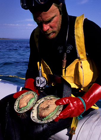
Though his fathers passion turned from farming on land to the valuable-if-difficult work of abalone diving. It is an ultimate fishing in part because the abalone are not swimming. Rather, they are suctioned to deep rocks, hidden by kep and seagrass, protected by a hardened shell. If you can find them, and pry them off their roost, profits are good. But it requires divers – there are only 125 across all ofTasmania – to spend 5, 6 hours a day deep beneath the surface attached by breathing hose to a compressor.
It’s not what you would call an easy profession. But Charles father, and uncle, got rich diving for the highly valued fish … and now Charles has followed in their swim strokes.
Six, sometimes seven days a week Charles dives for most of 11 months a year. He averages a ton of abalone a week, almost all destined for Hong Kong and China. Working out of one of three boats, with a solitary “deckie” as assistant, in waters ranging from 50 degrees to 70, his days are spent – depending on where the winds are blowing, working 25 to 40 feet below the surface, often in areas he’s fished before.
Interestingly, he considered himself more of a gardener than a hunter. By being patient, taking abs only when they are big and then re-seeding the most productive growing spots with young abs grown in a controlled farm of tanks behind his work shed, he actively “grows” his business.
Tasmania produces 25 percent of the world’s abalone. The early divers … and their financial partners who often own the licenses … have grown wealthy. Charles is still in the hard-work stage .. and looks forward to a day when he might be able to hire another diver to work with him, and all him some more time off.
His major gripe is that the license-holders themselves aren’t investing enough in the restocking of the best-growing sites. With a kilo selling for $39 straight out of the sea and ultimately for more than $100 for a half kil by the time it is on a customer’s plate in a Hong Kong restaurant … he thinks re-investing should be a no-brainer.
“That’s the kind of stuff that drives me crazy, that’s what I’ll think about when I’m diving,” he admits, as he hangs his 9 millimeter thick wet suit on a line to dry.
“But when we are motoring out there at sunrise, with only the waking mutton birds as company, it’s so beautiful that I forget all about those things …that’s what makes it all worthwhile.”
DISPATCH SIXTEEN
I
t is full-on summer now, the end of a hot, sunny Friday afternoon on Flinders Island … and nearly the end of our month-long stay in Tasmania. So … we do the only right and righteous thing, which is load a Zodiac behind Charles’ Land Cruiser and head up-coast. We’ll spend the late afternoon “hunting” a few abalone and crayfish for a personal feast, and make camp on Roydon Island, a small, beautiful lump of sand and brush just a couple kilometers off shore. We are joined by Charles’ good and beautiful friend, Fiona Stewart, who has lived mostly on the island all her life, is a graphic designer and illustrator and is currently playing mo to a six-month old wombat rescued from the pouch of a real mom hit by a car along the road, a very very common occurrence.
Trailering the Zodiac over rocks and into the water, Charles suits up in full-on dive gear – wetsuit, weight belt, mask, fins and with a compressor driven regulator in his mouth and long yellow air tube snaking behind, armed with a modified screwdriver for measuring and prying abs off their below-sea rocks, he’s over the edge, head first. Though I’m sure it feels like work to him, since we will be eating these abs ourselves, he is slowly getting into the weekend mode. I follow in the Zodiac as he scours the ocean floor, careful not to run over the floating yellow lifeline ….
Fifteen minutes later and an air-filled buoy floats to the surface, carrying a half-dozen green-lipped abs in a mesh bag.
Still in his wetsuit, we whip up the west coast of a cove where Charles knows – at least suspects – live some giant lobsters. Along the way we pass through a pack of 30 or more big dolphins, swimming against the currents, feeding. Rising out of the water in pairs and trios and – once a dozen abreast.
Fiona and Travis dive in first, in snorkel and masks; Charles tries with just the same kit, but is quickly back in the boat turning on the compressor. He’s going deep this time, more than 40 feet, looking under ledges for those big, 2.5 foot long crays.
With enough lobster and abalone to feed five times as many people – the big lobsters crawling over the metal floor of the boat – we race back to Roydon against a backdrop of sea spray and sunset.
Alex slices the abs into thin strips – easily a few hundred dollar at any restaurant – and we search for a pot big enough to boil the giant lobsters in. The best we can do is a slightly beat-up red pail, which works perfectly.
Stuff on abs, panfried with garlic and onion and awaiting the cray to boil, we slip down to the beach, in the now dark, to watch, silently, as a rookery of several dozen penguins comes ashore … swimming up to the beach, then waddling uphill through the sand.
The wind picks up around midnight and the sky is ablaze with stars. It may be the most beautiful night of our month long exploration. Made even moreso by the camaraderie of friends, old and new, and it is so beautiful and knowing the next days will involve packing and planes and a return to less wild places, it is nearly impossible for me to sleep.
It has been a jam-packed and powerful experience here and as my mind traces back over the places we’ve seen, the knowledge we’ve gained of this truly lovely people we have met … I’m feeling a bit disoriented, unsure whether to go … or simply stay, here in this island paradise.
We leave the beach very early under a beautiful pink and pale blue morning sky, lingering stars and a translucent sliver of moon glowing above… it all leaves me with a magical feeling …..